John Hughes Clarke

Center for Coastal and Ocean Mapping
University of New Hampshire
Durham NH 03824 USA
email jhc@ccom.unh.edu
John Hughes-Clarke is a Professor in the Center for Coastal and Ocean Mapping at the University of New Hampshire and an Adjunct Professor in the Ocean Mapping Group at the University of New Brunswick. His primary fascination is with marine sediment transport, particularly in deep water. To investigate these processes, he has specialized in the use of acoustic swath sonar systems. His original exposure to swath systems was in 1984 looking at the record of the 1929 turbidity current. Since that time, he has increasingly focused on the information content available from those systems (bathymetry, seabed and water column scattering). Since 1991, he has been part of, and until 2015, the chair of the Ocean Mapping Group at the UNB in Canada. At UNH his predominant role is as part of the Center for Coastal and Ocean Mapping where he teaches, supervises and conducts research in ocean mapping.
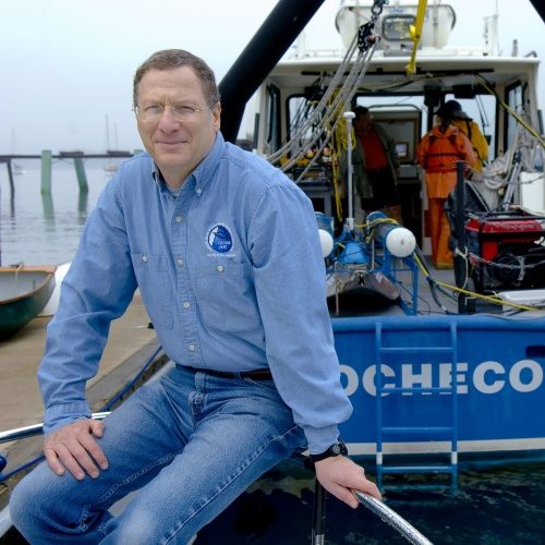
Larry Mayer
Center for Coastal and Ocean Mapping
University of New Hampshire
Durham NH 03824 USA
email lmayer@unh.edu
Larry Mayer is a Professor and Director of The Center for Coastal and Ocean Mapping at the University of New Hampshire. He received a Ph.D. from the Scripps Institution of Oceanography in Marine Geophysics in 1979. After being selected as an astronaut candidate finalist for NASA’s first class of mission specialists, Larry went on to a Post-Doc at the School of Oceanography at the University of Rhode Island where he worked on the early development of the Chirp Sonar and problems of deep-sea sediment transport and paleoceanography. From 1991 to 2000, Larry held the NSERC Chair in Ocean Mapping at the University of New Brunswick and in 2000, Larry became the founding director of the Center for Coastal and Ocean Mapping at the University of New Hampshire. Larry has participated in more than 95 cruises (over 80 months at sea!) during the last 38 years including 14 mapping expeditions in the ice-covered regions of the high Arctic. He is the recipient of the Keen Medal for Marine Geology and an Honorary Doctorate from the University of Stockholm. He was a member of the President’s Panel on Ocean Exploration and chaired National Academy of Science studies on national needs for coastal mapping and charting and the impact of the Deepwater Horizon Spill on ecosystem services in the Gulf of Mexico. He was the co-chair of the NOAA’s Ocean Exploration Advisory Working Group, the Vice-Chair of the Consortium of Ocean Leadership’s Board of Trustees, the Chair of the National Academies of Science’s Oceans Studies Board. He is is currently chair of the U.S. Committee for the Decade of Ocean Science, a member of the State Dept.’s Extended Continental Shelf Task Force, the Navy’s SCICEX Advisory Committee, and Chair of the Board of the Ocean Exploration Trust. In 2016 Larry was appointed by President Obama to the Arctic Research Commission, in 2017 he was elected to the Hydrographic Society of America Hall of Fame. In 2018 he was elected to the National Academy of Engineering and in 2019 he was elected as a foreign member of the Royal Swedish Academy of Sciences. In 2020 Larry became the first recipient of the Walter Munk Medal from The Oceanography Society and was elected a Fellow of the American Geophysical Union. In 2021 he was elected to the Norwegian Scientific Academy for Polar Research and in 2022 received the Sam Masry Prize from the Canadian Hydrographic Association. In 2024, Larry waw appointed Chair of the U.S. Arctic Research Commission. Larry’s current research deals with sonar imaging and remote characterization of the seafloor as well as advanced applications of 3-D visualization to ocean mapping problems and applications of mapping to Law of the Sea issues, particularly in the Arctic.
Tom Weber

https://ccom.unh.edu/user/weber
Underwater and Acoustic Systems
MITRE
email tomweber503@gmail.com
Tom Weber is a Principal Underwater Acoustics Engineer at MITRE and was previously a Program Officer at the Office of Naval Research and an Associate Professor of Mechanical Engineering at the University of New Hampshire (UNH), where he worked in the Center for Coastal and Ocean Mapping. His research focuses on underwater acoustics and acoustical oceanography, including the mapping and characterization of deep-sea bubble plumes. He received his B.S. and M.S. degrees in ocean engineering from the University of Rhode Island and his Ph.D. in Acoustics from Penn State. He was the recipient of the Medwin Prize in Acoustical Oceanography by the Acoustical Society of America (ASA) in November 2016 for his work on acoustic propagation and scattering in fluids containing gas bubbles, the application of acoustic technologies to fisheries science, high-frequency acoustic characterization of the seafloor, and sonar engineering.
Ian Church

Ocean Mapping Group
University of New Brunswick
Fredericton NB E3A 5A3 Canada
email ian.church@unb.ca
Dr. Ian Church is an Associate Professor in the Department of Geodesy and Geomatics Engineering and the Assistant Dean of Engineering at UNB. He leads the Ocean Mapping Group and is the chair of the Canadian Ocean Mapping Research and Education Network (COMREN). He specializes in ocean mapping research and training with 20 years of experience in the field. He runs the IHO/FIG/ICA S5 Category-A recognized degree program at UNB and won the UNB Allan P. Stuart Award for Excellence in Teaching in 2022. His primary research interests are currently automated multibeam sonar data processing and quality assurance, applied physical ocean modelling simulations, and coastal vertical datums. He has a BScE, MScE and PhD in Geomatics Engineering from UNB and previously worked as an Assistant Professor of Marine Science with the Hydrographic Science Research Center at the University of Southern Mississippi (Stennis Space Center campus). He manages the seabed mapping Research Vessel Heron, based on Vancouver Island, and has been involved with sonar data acquisition, management and student training on the Canadian Coast Guard Ship Amundsen since 2005.
Coordinator
Lindsay Gee

Ocean Mapping Training llc
info@mbcourse.com
Lindsay Gee has over four decades of broad experience working in the international hydrographic surveying, ocean mapping and offshore industry. His career had several phases, with an initial seventeen years at a national hydrographic service followed by eight years consulting in the broader offshore and hydrographic industry. This was followed by sixteen years leading an innovative company providing software and services to the international hydrographic industry, before he returned to managing mapping and science operations at-sea for five years and further consulting.
Lindsay is also deeply interested in the training and certification of personnel in the industry and has been the convenor for over thirty years of UNB OMG/UNH CCOM Multibeam Courses in North and South America, Europe, Asia and the Pacific.
He was a member of the NOAA Hydrographic Services Review Panel and is now a member of the THSOA/NSPS Hydrographic Certification Board.